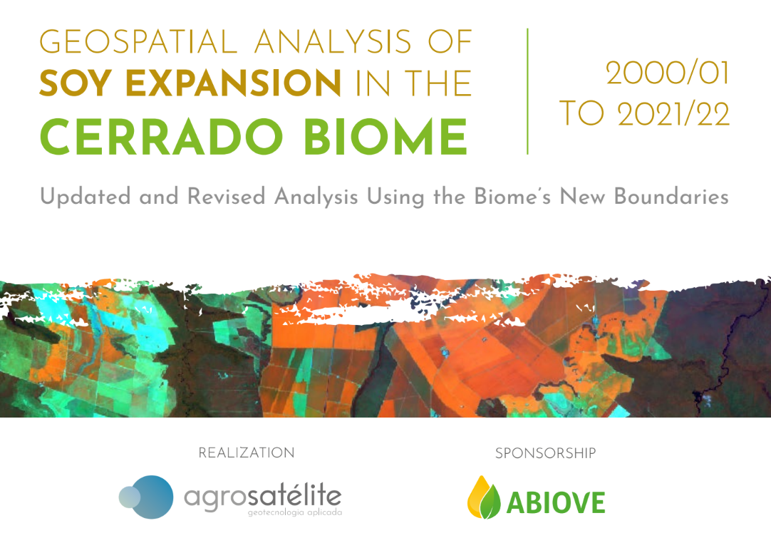
This report presents an updated version of the geospatial analysis of soy expansion, taking into consideration the new boundaries of the Cerrado Biome, on a scale of 1:250,000 (IBGE, 2019), and has the objective to use satellite images to portray the dynamics of change in land use associated with soy crops. In addition, it extends the analysis to include the 2021/22 crop year.
The new version of the Brazilian Biome Map, made it necessary to align the analyses in this study with the new boundaries for the Cerrado Biome that suffered a change in area, going from 204.01 million hectares to 198.46 million hectares. Although this reduction corresponds to just 2.7%, the Biome lost 20.06 million hectares and gained 14.51 million hectares, thereby justifying this new assessment of soy expansion dynamics based on the new and more refined sizing of the Cerrado Biome.
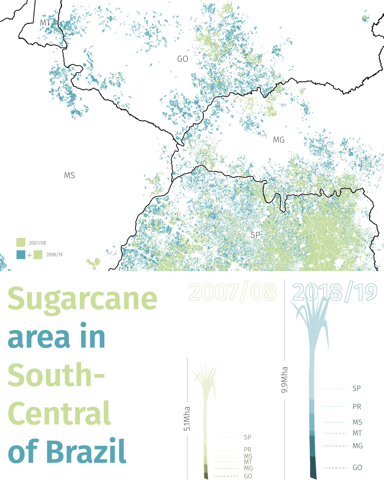
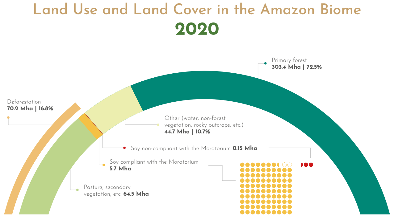
The soy area has practically tripled over the last 21 years, going from 7.43 million hectares in 2000/01 to 21.43 million hectares in 2021/22. This area represents almost 11% of the Biome and 51.7% of Brazil’s current soy area, according to Agrosatélite’s survey based on satellite images. The average growth rate in the period 2001-2022 was 0.667 million hectares per year; however, this average annual rate has increased over the last two years to 1.321 million hectares (1.172 million hectares in 2020/21 and 1.470 million hectares in 2021/22). In MATOPIBA, the soy area went from 0.965 million hectares in 2000/01 to 5.086 million hectares in 2021/22, more than a fivefold increase, taking this region’s share in the Cerrado’s soy area from 13% to 24%. In Other States, the soy area went from 6.47 million hectares in 2000/01 to 16.35 million hectares in 2021/22, a 2.5-fold increase representing 76% of the Cerrado’s current soy area.
A detailed analysis of the dynamics of the change in land use and cover associated with the soy expansion of 5.89 million hectares in the period 2013/14 to 2021/22 shows that change occurs both through incorporation of new areas from the conversion of native vegetation or intensification of land use from the conversion of pastures, and through agricultural management practices from crop rotation or fallow land. In Other States, expansion due to intensification (expanding onto pastures) amounted to 2.81 million hectares and expansion with deforestation amounted to 0.19 million hectares. In MATOPIBA, the expansion of only 0.40 million hectares was onto pastures, while 0.70 million hectares was expansion with deforestation. In both regions, a significant part of the soy expansion was onto land that was fallow in the 2013/14 crop year (2.25 million hectares).
Based on the analyses carried out in this study, the Cerrado Biome’s soy expansion trend has continued in an accelerated manner over the last two crop years. In the most recent period, soy expansion onto land converted from native vegetation is relatively low in the Other States region, but still persists in MATOPIBA.
Report available below:
Geospatial Analysis of Soy Crop on the Cerrado biome 2021/22:
an updated and revised analysis using the biome’s new boundaries
view report
The geospatial analysis of soybeans in the Cerrado biome has just undergone an update that considers the soybean expansion since crop year 2000/01, emphasizing the period from 2013/14 to 2018/19. The study incorporates a broad analysis of the land use and land cover change associated with soy expansion, as well as a reanalysis of the soy agricultural aptitude in terms of edaphoclimatic conditions and restrictions to slope and altitude.
The study was financed by ABIOVE, the Brazilian Association of Vegetable Oil Industries, motivated by the formulation of a financial compensation mechanism in exchange for preserving the surplus of native vegetation in soybean-producing properties of the Cerrado biome.
Report available below: